Category:Great Linford
Jump to navigation
Jump to search
English: Great Linford is a historic village, district and civil parish in the northern part of Milton Keynes, England, between Wolverton and Newport Pagnell.
Norsk bokmål: Great Linford er en historisk landsby som nå ligger innenfor byen Milton Keynes i England. Den ligger i ytterkanten av byen, mot Newport Pagnell. Frem til 1967 var den en selvstendig landsby i Buckinghamshire, men den er nå et verdslig sogn innenfor byen.
village and civil parish in Buckinghamshire, UK  | |||||
| Upload media | |||||
| Instance of | |||||
|---|---|---|---|---|---|
| Location | City of Milton Keynes, Buckinghamshire, South East England, England | ||||
 | |||||
Subcategories
This category has the following 6 subcategories, out of 6 total.
A
G
- Great Linford Almshouses (10 F)
- Great Linford Brickworks (5 F)
- Great Linford Manor (5 F)
N
- The Nags Head, Great Linford (2 F)
T
Media in category "Great Linford"
The following 200 files are in this category, out of 235 total.
(previous page) (next page)-
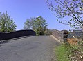
 A422 Bridge, M1 - geograph.org.uk - 4695045.jpg 640 × 385; 29 KB
-
 A422 Bridge, M1 - geograph.org.uk - 4725632.jpg 640 × 426; 38 KB
-
 A509 Portway in Milton Keynes - geograph.org.uk - 4752567.jpg 800 × 556; 109 KB
-
 Approaching Great Linford roundabout - geograph.org.uk - 1207459.jpg 640 × 480; 49 KB
-
 Arts Centre sign, Great Linford - geograph.org.uk - 1157675.jpg 640 × 480; 72 KB
-
 Arts Centre, Great Linford - geograph.org.uk - 1272835.jpg 640 × 390; 79 KB
-
 Back exit from Service Area - geograph.org.uk - 4831553.jpg 4,608 × 3,456; 4.91 MB
-

-
 Barn to West of Linford Manor.jpg 5,760 × 2,957; 5.59 MB
-
 Blakelands medical centre - geograph.org.uk - 2922368.jpg 640 × 429; 79 KB
-
 Bridge 76, Grand Junction Canal - geograph.org.uk - 2712723.jpg 4,000 × 3,000; 5.09 MB
-
 Bridge 76A, Grand Union Canal - geograph.org.uk - 6323934.jpg 1,280 × 851; 506 KB
-
 Bridge 76a, Grand Union Canal - geograph.org.uk - 819148.jpg 640 × 480; 127 KB
-
 Bridge 77, Grand Junction Canal - geograph.org.uk - 2712736.jpg 4,000 × 3,000; 4.86 MB
-
 Bridge 78 over the Grand Union - geograph.org.uk - 2922367.jpg 640 × 427; 85 KB
-
 Bridge 78, Grand Junction Canal - geograph.org.uk - 2712762.jpg 4,000 × 3,000; 4.9 MB
-
 Bridge 78A, Grand Junction Canal - geograph.org.uk - 2876453.jpg 4,000 × 3,000; 4.93 MB
-
 Bridge 78B, Grand Junction Canal - geograph.org.uk - 2712924.jpg 4,000 × 3,000; 4.67 MB
-

-
 Bridge 79, Grand Junction Canal - geograph.org.uk - 2713118.jpg 4,000 × 3,000; 4.87 MB
-
 Bridge 79A, Grand Junction Canal - geograph.org.uk - 2713228.jpg 4,000 × 3,000; 5.18 MB
-
 Bridge 79B, Grand Junction Canal - geograph.org.uk - 2713241.jpg 4,000 × 3,000; 5.02 MB
-
 Bridge 79C, Grand Junction Canal - geograph.org.uk - 2876464.jpg 4,000 × 3,000; 4.85 MB
-
 Bridge 79D, Grand Junction Canal - geograph.org.uk - 2876468.jpg 4,000 × 3,000; 4.53 MB
-
 Bridge 80, Grand Junction Canal - geograph.org.uk - 2876506.jpg 4,000 × 3,000; 4.64 MB
-
 Bridge 80A over the Grand Union - geograph.org.uk - 2922320.jpg 640 × 427; 89 KB
-
 Bridge 80A, Grand Junction Canal - geograph.org.uk - 2876478.jpg 4,000 × 3,000; 5.02 MB
-
 Bridge 81, Grand Junction Canal - geograph.org.uk - 2713250.jpg 4,000 × 3,000; 4.82 MB
-
 Bridge across Grand Union Canal - geograph.org.uk - 2314797.jpg 480 × 640; 107 KB
-

-
 Bridge over entrance to Pennyland Boat Basin - geograph.org.uk - 2876524.jpg 4,000 × 3,000; 4.65 MB
-
 Bridge over M1 - geograph.org.uk - 2496020.jpg 640 × 480; 54 KB
-
 Bridges, M1 - geograph.org.uk - 4725629.jpg 640 × 426; 42 KB
-
 Bus Stop - geograph.org.uk - 819162.jpg 640 × 480; 108 KB
-
 Canal Bridge near Great Linford - geograph.org.uk - 2334507.jpg 640 × 462; 114 KB
-
 Canal bridge, Giffard Park - geograph.org.uk - 2334376.jpg 640 × 457; 109 KB
-
 Canal Bridge, Great Linford - geograph.org.uk - 1272720.jpg 640 × 476; 72 KB
-
 Canal Bridge, Marsh Drive - geograph.org.uk - 1272760.jpg 640 × 475; 87 KB
-
 Canalside open space, Great Linford - geograph.org.uk - 1272920.jpg 640 × 476; 96 KB
-
 Cape End - geograph.org.uk - 3764185.jpg 640 × 478; 46 KB
-
 Cherry tree roundabout - geograph.org.uk - 2922369.jpg 480 × 640; 84 KB
-
 CMG Rescue Services, Newport Pagnell, M1 northbound - geograph.org.uk - 1965933.jpg 2,000 × 1,496; 193 KB
-
 Conniburrow Pavilion - geograph.org.uk - 208574.jpg 640 × 480; 122 KB
-
 Cranesbill Place, Milton Keynes - geograph.org.uk - 1206378.jpg 640 × 426; 191 KB
-

-
 Dansteed Way Bridge No 80 - geograph.org.uk - 4749944.jpg 800 × 606; 155 KB
-
 Downs Barn Boulevard - geograph.org.uk - 231678.jpg 640 × 480; 107 KB
-
 Dual use path, Great Linford - geograph.org.uk - 2334408.jpg 640 × 480; 125 KB
-
 Entrance to Neath Hill - geograph.org.uk - 1168830.jpg 640 × 480; 69 KB
-
 Footbridge across Marlborough Street - geograph.org.uk - 4752584.jpg 800 × 554; 118 KB
-

-

-

-

-
 Footbridge over Darley Gate - geograph.org.uk - 5682638.jpg 1,600 × 1,066; 355 KB
-
 Footbridge over Portway - geograph.org.uk - 5682632.jpg 1,600 × 1,066; 319 KB
-
 Footbridge over the M1 - geograph.org.uk - 4695014.jpg 640 × 366; 31 KB
-
 Footbridge over the M1 - geograph.org.uk - 4695040.jpg 640 × 426; 41 KB
-
 Footbridge over the M1 - geograph.org.uk - 4725626.jpg 640 × 426; 44 KB
-

-
 Footbridge, Milton Keynes - geograph.org.uk - 2334779.jpg 640 × 466; 94 KB
-
 Footpath, Great Linford - geograph.org.uk - 1272890.jpg 640 × 475; 105 KB
-

-
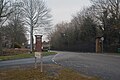
 Gate to Great Linford Manor Park - geograph.org.uk - 1207394.jpg 640 × 480; 81 KB
-
 GfLogo.png 170 × 91; 11 KB
-
 Grand Union Canal - geograph.org.uk - 2334550.jpg 640 × 480; 95 KB
-

-
 Grand Union Canal Walk - geograph.org.uk - 5627945.jpg 640 × 480; 92 KB
-
 Grand Union Canal Walk - geograph.org.uk - 5627955.jpg 640 × 480; 61 KB
-
 Grand Union Canal Walk - geograph.org.uk - 5627969.jpg 640 × 480; 88 KB
-
 Grand Union Canal Walk - geograph.org.uk - 5627987.jpg 640 × 480; 82 KB
-
 Grand Union Canal Walk - geograph.org.uk - 5627993.jpg 640 × 480; 92 KB
-
 Grand Union Canal, Bridge Number 76 - geograph.org.uk - 3674576.jpg 640 × 480; 73 KB
-
 Grand Union Canal, Bridge Number 76A - geograph.org.uk - 3674619.jpg 640 × 480; 109 KB
-
 Grand Union Canal, Bridge Number 77 - geograph.org.uk - 3674735.jpg 640 × 480; 83 KB
-
 Grand Union Canal, Bridge Number 78 - geograph.org.uk - 3674841.jpg 640 × 480; 70 KB
-
 Grand Union Canal, Bridge Number 78B - geograph.org.uk - 3675679.jpg 640 × 475; 73 KB
-
 Grand Union Canal, Bridge Number 79 - geograph.org.uk - 3675701.jpg 640 × 480; 107 KB
-
 Grand Union Canal, Bridge Number 79A - geograph.org.uk - 3675722.jpg 640 × 480; 68 KB
-
 Grand Union Canal, Bridge Number 79B - geograph.org.uk - 3675738.jpg 640 × 480; 77 KB
-
 Grand Union Canal, Bridge Number 79C - geograph.org.uk - 3675763.jpg 640 × 480; 84 KB
-
 Grand Union Canal, Bridge Number 79D - geograph.org.uk - 3676135.jpg 640 × 480; 71 KB
-
 Grand Union Canal, Bridge Number 80A - geograph.org.uk - 3676198.jpg 640 × 480; 76 KB
-
 Grand Union Canal, Bridge Number 81 - geograph.org.uk - 3676332.jpg 640 × 480; 93 KB
-
 Grand Union Canal, Giffard Park - geograph.org.uk - 531196.jpg 640 × 428; 122 KB
-

-

-

-

-

-

-
 Great Linford Arts Workshops - geograph.org.uk - 1157681.jpg 640 × 480; 73 KB
-
 Great Linford fairy - geograph.org.uk - 4111804.jpg 1,004 × 1,024; 296 KB
-
 Great Linford pavilion - geograph.org.uk - 2922361.jpg 640 × 427; 73 KB
-
 Great Linford Railway Bridge No 76A - geograph.org.uk - 4748213.jpg 800 × 478; 125 KB
-
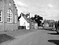
 Great Linford Village Hall - geograph.org.uk - 1207401.jpg 640 × 480; 69 KB
-
 Green near Great Linford - geograph.org.uk - 2334431.jpg 640 × 480; 114 KB
-
-
 Landing stages in Tongwell Lake - geograph.org.uk - 2922381.jpg 640 × 427; 61 KB
-
 Landscaped woods beside Stonepit Field - geograph.org.uk - 1201527.jpg 640 × 480; 137 KB
-
 Linford Bridge No 78 - geograph.org.uk - 4748369.jpg 800 × 555; 127 KB
-
 Linford Wharf - geograph.org.uk - 407878.jpg 427 × 640; 94 KB
-
 Linford Wharf Bridge No 77 - geograph.org.uk - 4748348.jpg 800 × 600; 113 KB
-

-
 Little Linford Lane as it crosses the Great Ouse - geograph.org.uk - 2926712.jpg 1,752 × 1,167; 1.23 MB
-
 Little Linford Lane Bridge, M1 - geograph.org.uk - 4695022.jpg 640 × 415; 40 KB
-
 Little Linford Lane Bridge, M1 - geograph.org.uk - 4725612.jpg 640 × 426; 41 KB
-

-

-

-
 M1 motorway - A422 bridge, Tongwell - geograph.org.uk - 2897385.jpg 640 × 480; 53 KB
-

-

-

-
 M1 motorway - Tongwell Lane bridge - geograph.org.uk - 2897386.jpg 640 × 480; 56 KB
-
 M1 motorway at Newport Pagnell - geograph.org.uk - 2834408.jpg 640 × 480; 68 KB
-
 M1 motorway at Newport Pagnell service area - geograph.org.uk - 2630052.jpg 1,024 × 613; 147 KB
-
 M1 motorway crossing Wolverton Road - geograph.org.uk - 2897406.jpg 640 × 480; 50 KB
-

-
 M1 near to Newport Pagnell - geograph.org.uk - 6263002.jpg 800 × 533; 507 KB
-
 M1 Welcome Break - geograph.org.uk - 2494172.jpg 640 × 427; 72 KB
-
 M1, southbound - geograph.org.uk - 4725624.jpg 640 × 426; 38 KB
-
 Manor Gates, Great Linford - geograph.org.uk - 1272781.jpg 640 × 480; 107 KB
-
 Manor grounds, Great Linford - geograph.org.uk - 1272931.jpg 640 × 480; 104 KB
-
 Manor grounds, Great Linford - geograph.org.uk - 1272957.jpg 640 × 480; 123 KB
-
 Manor Ponds Great Linford - geograph.org.uk - 1156547.jpg 640 × 480; 116 KB
-
 Martingale Place, Downs Barn - geograph.org.uk - 2334656.jpg 640 × 480; 82 KB
-
 Milestone 34 - geograph.org.uk - 4796796.jpg 4,273 × 3,108; 2.86 MB
-
 Milton Keynes , Brickhill Street - geograph.org.uk - 5732895.jpg 6,000 × 4,000; 7.51 MB
-
 Milton Keynes , Brickhill Street - geograph.org.uk - 5732896.jpg 6,000 × 4,000; 6.76 MB
-
 Milton Keynes , Brickhill Street - geograph.org.uk - 5732901.jpg 6,000 × 4,000; 7.82 MB
-
 Milton Keynes , Brickhill Street - geograph.org.uk - 5732907.jpg 6,000 × 4,000; 6.49 MB
-
 Milton Keynes , Brickhill Street - geograph.org.uk - 5732934.jpg 6,000 × 4,000; 6.83 MB
-
 Milton Keynes , Brickhill Street - geograph.org.uk - 5732936.jpg 6,000 × 4,000; 6.91 MB
-
 Milton Keynes , Brickhill Street - geograph.org.uk - 5732938.jpg 6,000 × 4,000; 6.77 MB
-
 Milton Keynes , Brickhill Street - geograph.org.uk - 6113642.jpg 6,000 × 4,000; 7.9 MB
-
 Milton Keynes , Brickhill Street - geograph.org.uk - 6113643.jpg 6,000 × 4,000; 7.5 MB
-
 Milton Keynes , Brickhill Street - geograph.org.uk - 6113644.jpg 6,000 × 4,000; 3.16 MB
-
 Milton Keynes , Clayton Gate - geograph.org.uk - 5732905.jpg 6,000 × 4,000; 7.16 MB
-
 Milton Keynes , Currier Drive - geograph.org.uk - 5732945.jpg 5,868 × 3,912; 6.61 MB
-
 Milton Keynes , Dansteed Way - geograph.org.uk - 5732897.jpg 5,771 × 3,848; 6.67 MB
-
 Milton Keynes , Giffard Park Roundabout - geograph.org.uk - 5732912.jpg 6,000 × 4,000; 7.74 MB
-
 Milton Keynes , H3 Monks Way A422 - geograph.org.uk - 5979894.jpg 6,000 × 4,000; 7.52 MB
-
 Milton Keynes , Horton Gate - geograph.org.uk - 5732910.jpg 6,000 × 4,000; 7.81 MB
-
 Milton Keynes , Lovat Fields Retirement Village - geograph.org.uk - 5732891.jpg 6,000 × 4,000; 7.42 MB
-
 Milton Keynes , Lovat Fields Retirement Village - geograph.org.uk - 5732893.jpg 6,000 × 4,000; 7.66 MB
-
 Milton Keynes , Marlborough Street B4034 - geograph.org.uk - 5732943.jpg 6,000 × 4,000; 6.29 MB
-
 Milton Keynes , Marlborough Street B4034 - geograph.org.uk - 5979898.jpg 6,000 × 4,000; 7.16 MB
-
 Milton Keynes , Monks Way A422 - geograph.org.uk - 5732900.jpg 5,643 × 3,763; 6.73 MB
-
 Milton Keynes , Monks Way A422 - geograph.org.uk - 5732939.jpg 5,890 × 3,927; 6.42 MB
-
 Milton Keynes , Monks Way A422 - geograph.org.uk - 5732941.jpg 6,000 × 4,000; 7.01 MB
-
 Milton Keynes , Monks Way A422 - geograph.org.uk - 5979896.jpg 6,000 × 4,000; 7.68 MB
-
 Milton Keynes , Overstreet - geograph.org.uk - 5732940.jpg 6,000 × 4,000; 6.37 MB
-
 Milton Keynes , Overstreet - geograph.org.uk - 5979897.jpg 6,000 × 4,000; 7.6 MB
-
 Milton Keynes , Portway A509 - geograph.org.uk - 5732946.jpg 6,000 × 4,000; 6.62 MB
-
 Milton Keynes , Portway A509 - geograph.org.uk - 5732947.jpg 5,935 × 3,957; 7.78 MB
-
 Milton Keynes , Redbridge Roundabout - geograph.org.uk - 5732942.jpg 6,000 × 4,000; 6.9 MB
-
 Milton Keynes , Redvers Gate - geograph.org.uk - 5732898.jpg 6,000 × 4,000; 6 MB
-
 Milton Keynes , St Leger Drive - geograph.org.uk - 6113641.jpg 6,000 × 4,000; 3.68 MB
-
 Milton Keynes , Tanners Drive - geograph.org.uk - 5732933.jpg 5,784 × 3,857; 5.91 MB
-
 Milton Keynes , V10 Brickhill Street - geograph.org.uk - 5979895.jpg 6,000 × 4,000; 6.11 MB
-
 Milton Keynes , Wedgwood Avenue - geograph.org.uk - 5732935.jpg 6,000 × 4,000; 7.16 MB
-
 Milton Keynes , Yeomans Drive - geograph.org.uk - 5732937.jpg 6,000 × 4,000; 6.94 MB
-
 Monks Way Bridge No 79A - geograph.org.uk - 4749119.jpg 800 × 642; 133 KB
-
 Monks Way bridge over the M1 - geograph.org.uk - 4319938.jpg 640 × 480; 64 KB
-

-
 Narrowboats, Great Linford - geograph.org.uk - 1272901.jpg 640 × 474; 71 KB
-
 Newport Pagnell , Wolverton Road - geograph.org.uk - 5732932.jpg 5,942 × 3,961; 5.99 MB
-
 Newport Pagnell Canal - geograph.org.uk - 2712747.jpg 4,000 × 3,000; 4.57 MB
-
 Newport Pagnell Motorway Service Area - geograph.org.uk - 5506000.jpg 1,600 × 1,067; 380 KB
-
 Newport Pagnell Service Area - geograph.org.uk - 4120137.jpg 640 × 480; 64 KB
-
 Newport Pagnell Service Area, Lorry Park - geograph.org.uk - 5111376.jpg 640 × 427; 375 KB
-
 Newport Pagnell Services - geograph.org.uk - 2834389.jpg 640 × 480; 55 KB
-
 Newport Pagnell Services - geograph.org.uk - 2834401.jpg 640 × 480; 61 KB
-
 Newport Pagnell Services - geograph.org.uk - 3605563.jpg 4,468 × 2,999; 2.63 MB
-
 Newport Pagnell Services Northbound - geograph.org.uk - 2183254.jpg 800 × 600; 164 KB
-
 Newport Pagnell Services Northbound - geograph.org.uk - 2183259.jpg 800 × 600; 184 KB
-
 Newport Pagnell Services Northbound - geograph.org.uk - 2183261.jpg 800 × 600; 275 KB
-
 Newport Pagnell Services overbridge - geograph.org.uk - 4695029.jpg 640 × 408; 39 KB
-
 Newport Pagnell Services overbridge - geograph.org.uk - 4725617.jpg 640 × 426; 38 KB
-
 Newport Pagnell services, M1 northbound - geograph.org.uk - 1965941.jpg 2,000 × 1,500; 191 KB
-
 Newport Pagnell Services, Northbound M1 - geograph.org.uk - 5111400.jpg 640 × 427; 364 KB
-
 Ordnance Survey Fundamental Bench Mark - geograph.org.uk - 3255739.jpg 3,264 × 2,448; 2.72 MB
-
 OS Fundamental Benchmark - geograph.org.uk - 5480329.jpg 640 × 480; 129 KB
-
 Parklands Pond, Great Linford - geograph.org.uk - 1272946.jpg 640 × 480; 91 KB
-

-

-
 Path and green space in Conniburrow - geograph.org.uk - 2844644.jpg 1,600 × 1,072; 580 KB
-
 Path and underpass to Willen - geograph.org.uk - 2922382.jpg 640 × 428; 91 KB
-
 Path and underpass towards Linford Wood - geograph.org.uk - 2922929.jpg 640 × 480; 117 KB
-
 Path at Great Linford - geograph.org.uk - 1272847.jpg 640 × 480; 114 KB
-
 Path crossing by the canal - geograph.org.uk - 2334467.jpg 640 × 446; 106 KB
-
 Path through to the cricket field - geograph.org.uk - 2922358.jpg 480 × 640; 154 KB
-

-
 Path, Conniburrow - geograph.org.uk - 2334690.jpg 640 × 460; 101 KB
-
 Path, Conniburrow - geograph.org.uk - 2334743.jpg 640 × 460; 83 KB
-
 Paths, Downs Barn - geograph.org.uk - 2334630.jpg 640 × 480; 139 KB
-
 Peartree Pond at Great Linford shops - geograph.org.uk - 1207560.jpg 640 × 480; 78 KB
-

-
 Pennyland houses early 1980s.jpg 920 × 1,352; 288 KB


_-_geograph.org.uk_-_5111387.jpg)


